Property Intelligence for Environmental Risk, Market Trends & Investment Decisions
Analyze environmental exposure, historical hazard activity, coastal risk, wildfire risk, ground stability, and long-term property intelligence — unified into one powerful decision platform.
Free access • No signup required • Instant property intelligence
How VerraCore Works
Search a Property or Location
Search a property, ZIP code, city, or location to begin analyzing environmental and market intelligence.
Analyze Property Intelligence
We evaluate environmental exposure, coastal risk, wildfire risk, ground stability, historical hazards, and related property intelligence signals.
Get Actionable Intelligence
Receive property intelligence designed to support smarter buying, investing, and relocation decisions.
Explore Property Intelligence
Location Reports
Browse environmental risk, historical hazards, and property intelligence by city, state, and region.
Risk Patterns
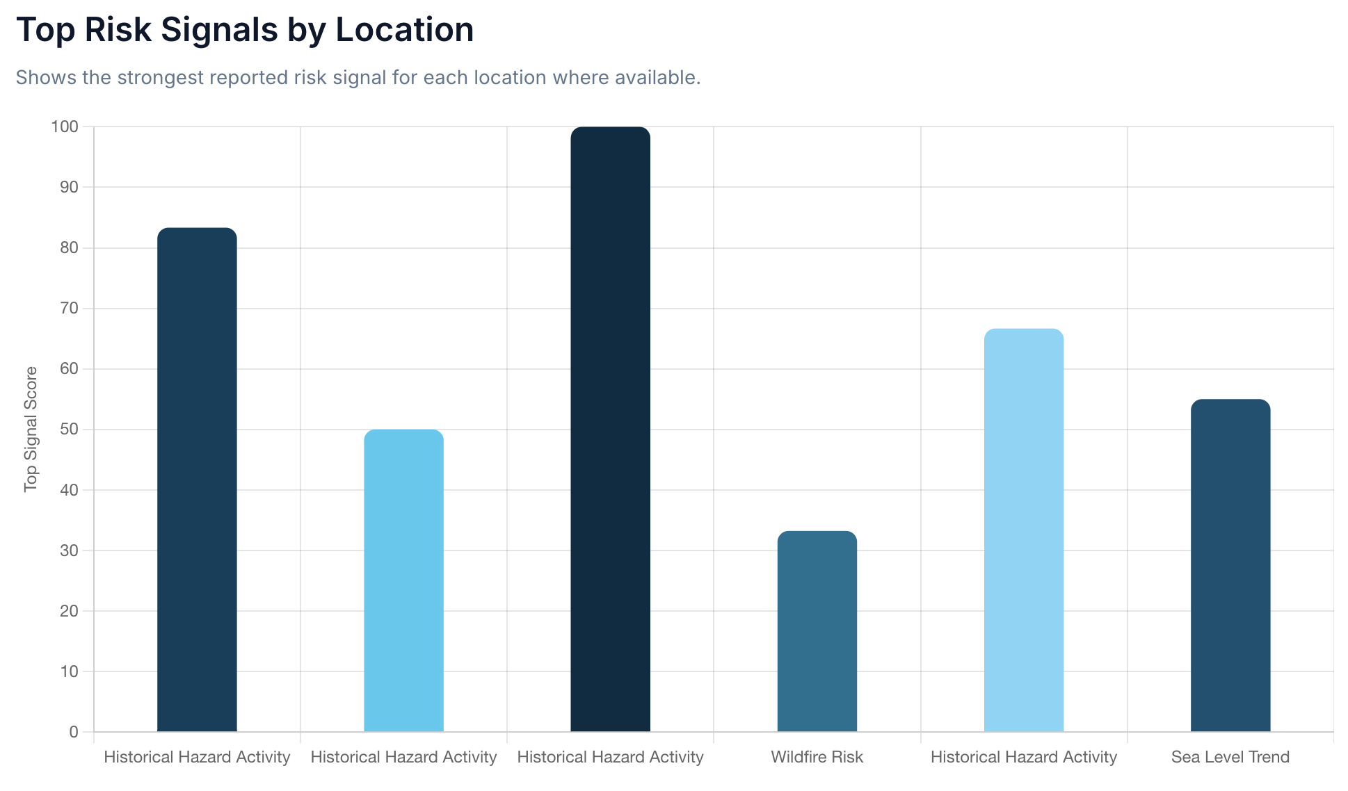
Explore how environmental and property risk signals vary across locations, hazard types, and regions.
Market Intelligence
Explore how risk and environmental exposure may affect property markets and investment decisions.
What VerraCore Intelligence Includes
Flood Exposure
Analyzes FEMA flood zones, historical flood exposure, and modeled flood sensitivity during major environmental events.
Sea Level Rise
Evaluates long-term sea level trend indicators and future coastal exposure scenarios where reporting data is available.
Storm Surge
Models potential coastal storm surge exposure using historical storm behavior, surge depth modeling, and coastal conditions.
Elevation
Measures relative elevation and low-lying terrain exposure that may increase long-term flooding sensitivity and environmental vulnerability.
High Tide Flooding
Evaluates recurring tidal flooding exposure and nuisance flooding sensitivity during elevated tidal conditions and seasonal coastal cycles.
Shoreline Erosion
Tracks long-term shoreline change patterns and coastal land-loss indicators that may affect nearby property exposure over time.
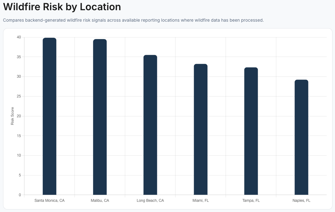
Wildfire Risk
Identifies wildfire exposure patterns and regional wildfire sensitivity using processed environmental hazard datasets.
Ground Stability
Evaluates land stability indicators and ground-related environmental risk signals where supporting datasets are available.
Historical Intelligence
Aggregates historical FEMA disasters, NOAA events, flood insurance claims, and related environmental event records.
Why VerraCore
Property Intelligence for Smarter Real Estate Decisions
Analyze environmental risk, historical hazard activity, and property intelligence signals to make more informed real estate decisions.
- Identify hidden environmental and property risks early
- Support smarter buying, investment, and relocation decisions
- Analyze environmental exposure patterns across locations
- Access clear intelligence without complex technical analysis
Make Smarter Coastal Property Decisions Today
Get instant insights on flood risk, erosion, insurance costs, and coastal exposure — all in one place.
Free to use • No signup required
Trusted by Coastal Property Buyers & Investors
Making coastal risk data simple, accessible, and actionable.
- Data-driven coastal risk insights
- Built for buyers, investors, and homeowners
- Designed for clarity and simplicity
Stay Updated on Coastal Risk Insights
Get updates on coastal risk trends, data insights, and new features.